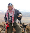
A four person survey team today walked northwards from Tel el Shahm fort towards back towards Wadi Rutm. Our aim was to find out whether there were intermediate military posts between the two stations. There were. We found a fort beside each of two viaducts, one of 20 arches, the other of 14. These clearly were vulnerable targets. The first fort, by the 20 span viaduct comprised a rectangular breastwork and rampart located on a slight rise that was intervisible with both Tel el Shahm and Wadi Rutm fort. The second by the 14 span viaduct was also located on a rise and comprised a small square enclosure, a small circular enclosure and a length of about 100 metres of trench between the two. This too was intervisible with both Tel el Shahm and Wadi Rutm forts.
The survey has therefore confirmed that the Ottoman counter insurgency strategy involved a line of intervisible defended points that also between them ensured that the entire railway line was under observation.
Work at the sit at Tel el Shahm throughout the day, in over 90 degrees of heat with little or no breeze to keep the flies away or mitigate its effect. On the top of the rocky outcrop where the remains of the standing buildings are being investigated (the place we now refer to as ‘upstairs’) recording continued apace. Just getting to this part of the site has proved challenging. With the steep, sandy, stony ascent the team arrive breathless at the top, but unbowed. The very nature of the terrain means that every foot placement made is precarious, and the normal recording methodology is made much more difficult for this.
One great find of the day was a small Ottoman button which probably came from a shirt epaulette, and was made by Nina our latest Jordanian recruit, who found it eyes only while sitting in a tent ring. So far the finds count at Tel el Shahm has been very low, significantly lower than previous years at similar sites and mush lower than anticipated here. However we have found some other Ottoman army uniform buttons, and in an unusually shaped and positioned feature to one side of the main lower camp with direct line of site to the station on the Hijaz line an Ottoman coin was unearthed, confirming together with the button the presence of the counter insurgency foces.


What a fascinating day you've had! The rock art is stunning and I find the fact that it seems to have been unknown until so recently really interesting: what else lies just awaiting discovery? Is your interest stimulating resarch by local academics and archaeologists? From experince of the conditions under foot that are shown in some of the pictures, I understand how difficult walking can but but the temperatures must make it so much harder. It's easy for us here, in chilly Britain, to envy you your sun but I'm sure it can be gruelling trying to do physical work in such conditions.
ReplyDeleteI'm wondering if it would be possible to feature either an image of a map on the blog or a link we can use to see exactly where you are and (if possible) how this relates to where you've been before, please? It would help your followers to contexturalise your work.
Have a good day tomorrow!